Independently Owned, Locally Grown, Community Loved

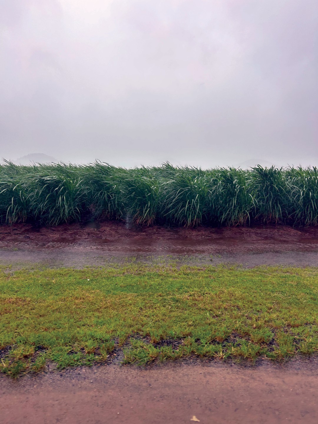
Ex-Tropical Cyclone Koji was the first tropical cyclone of the 2026 season to impact North Queensland, bringing damaging winds, heavy rainfall and flooding concerns to coastal and inland communities, including the Mackay Shire.
The system developed in the Coral Sea before intensifying into a tropical cyclone, marking the official start of the 2026 cyclone season. According to the Bureau of Meteorology (BOM), Koji reached category two strength while offshore before weakening as it approached the North Tropical Coast. Despite this downgrade, the system continued to pose a significant threat due to intense rainfall, strong wind gusts and the potential for river rises and flash flooding.
As Koji tracked westward towards the coast, emergency services and local disaster management groups across North Queensland activated preparedness and response measures to ensure communities were informed and supported. Forecasts indicated the system would cross the coast between Townsville and Bowen before continuing south and weakening further, with impacts expected to be felt across multiple local government areas.
Koji crossed the coast at reduced intensity; however, saturated catchments, ongoing rainfall and rising river levels prolonged the impacts well beyond landfall. Localised flooding, road closures and isolation concerns followed, highlighting the challenges often associated with wet season systems, even after they weaken below tropical cyclone strength.
The event served as a timely reminder of the unpredictability of the North Queensland wet season and the importance of preparedness early in the year.
Burdekin Life have prepared a comprehensive timeline and in-depth coverage into the event, outlining how Ex-Tropical Cyclone Koji unfolded across the Mackay Shire, detailing key warnings, emergency responses and significant developments from Saturday through to Tuesday.
Photo credit: Joseph Borg
.png)
Publishers Indemnity. Any individual or entity that places advertising, supplies copy material, or submits editorial content to Core Life Publishing agrees and undertakes to ensure that all such material:- Does not infringe upon any copyright, trademark, or other intellectual property rights;- Is free from any content that could be considered defamatory, libelous, or slanderous;- Does not infringe upon any rights related to privacy or breach of confidence;- Contains no obscene, indecent, or otherwise unlawful material;- Complies fully with the Trade Practices Act and all other applicable laws, regulations, or statutes.Furthermore, by submitting or placing such material, these individuals or entities agree to indemnify and hold harmless the publisher, Core Publishing and Events Pty Ltd, and/or its agents from and against any and all investigations, claims, demands, liabilities, damages, costs, or judgments arising out of or in connection with the material provided. All material is believed to be accurate at the time of printing and remains the copyright of Core Publishing and Events Pty Ltd.
© 2026 Mackay and Whitsunday Life Pty Ltd.


.png)